|

|
|
| Product Information: | ||
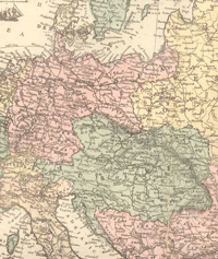
| Details: | 1873 Map of Prussia & Austria; 1 pp; Map; Published: 1873; 10.5x14; Item # FS059 This is a full color reproduction of a map of Prussia and Austria from Historical atlas of the world giving histories and maps of all the countries in their geographical statistical and commercial aspects, together with a complete history of the original surveys of the United States, with a special map showing lands surveyed by government by Charles Henry Jones & Theodore F. Hamilton. Areas include the northern portion of Italy and Turkey, Western Russia, Denmark and much more. All of these maps come in a protective, archival safe sleeve. |
|